The Indonesian government designed a massive infrastructure project to reshape the geopolitical landscape of the modern republic. The conceptualization of the Trans-Papua Road serves as a holistic connectivity backbone that cuts through the extreme topography of the eastern archipelago, transcending the technical definitions of standard highway construction. Authorities specifically created this political-economic instrument to end absolute spatial isolation, reduce regional disparities, and integrate inland communities into the national economic sphere. Although the New Order administration under President Soeharto historically conceptualized this route, the radical acceleration of financial capital and technology materialized exponentially through the recent “Nawacita” paradigm, which aims to build prosperity from the outermost peripheries to preserve the cohesion of the Unitary State of the Republic of Indonesia.
In total, planners designed the massive network to span 4,330 kilometers, covering a strategic corridor that stretches from the Bird’s Head region in Sorong City (Southwest Papua Province) to the Anim Ha land in Merauke (South Papua Province). The central administration incorporated this giant infrastructure project into the National Strategic Projects (PSN) and the 2020-2024 National Medium-Term Development Plan (RPJMN), reflecting its political status as a top priority to lower poverty rates and overcome development gaps in the New Autonomous Regions (DOB) of Papua. Multi-agency monitoring data released in mid-2021 documented that workers physically opened more than 3,446 kilometers of roads, while engineers focused the remaining efforts on critical mountainous segments with extreme elevation angles.
However, the transition from isolation to connectivity creates an incredibly complex, multidimensional discourse. On one extreme, this penetrating asphalt delivers unprecedented logistical efficiency across the Papuan highlands, directly lowering the high cost index of basic goods that long choked the purchasing power of mountain communities. Government bodies utilized this basic transport infrastructure as a prerequisite for commercial economic services, equitable public utility provision, and the entry of private facilities into districts that previously relied entirely on expensive pioneering flights.
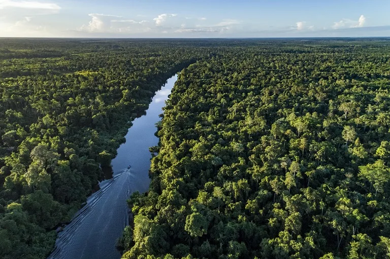
On the other extreme, implementation of the road triggers sociological disruptions and ecological friction that threaten the essence of harmony itself. The footprint of land clearing intersects directly with global conservation zones in highly fragile national parks. Sociologically, the acquisition of customary lands and the influx of free-market economic forces brought by migrants often expose the vulnerability of Indigenous Papuans (OAP), who gradually face marginalization from the economic arena. In addition, the militarization of civilian spaces—resulting from armed group disruptions opposing state projects—adds another layer of tension. Therefore, a comprehensive evaluation of this megaproject requires careful deconstruction of technical anatomy, microeconomic fluctuations, political ecology, customary law, and demographic dynamics to find an equilibrium between state ambitions and the protection of local community rights.
Technical Anatomy, Financing, and Spatial Configuration of the Trans-Papua Road
The spatial configuration of the West Papuan network demonstrates a civil engineering intervention specifically designed to respond to extreme geological variability. For the western region, workers successfully connected a 1,070.62-kilometer route, which managers divided into two primary administrative segments. Segment I, which spans 594.81 kilometers, functions as an artery integrating the commercial epicenter of Sorong City, continuing through the Maybrat region, and ending in the administrative hub of Manokwari. The presence of this segment reduces land travel time to just 14 hours and acts as an intermodal corridor connecting to the Port of Arar. The Port of Arar plays an essential role as a sea toll gateway for the Sorong Special Economic Zone (KEK). Out of the total length of Segment I, asphalt reinforces approximately 77 percent of the surface, leaving 134.88 kilometers of soil pavement that still requires 29.5 kilometers of geometric modifications to neutralize dangerous slopes.
Moving to Segment II, this route connects Manokwari through Mameh and Wasior to the geographical border of Papua Province with a linear length of 475,81 kilometers, achieving physical breakthrough in December 2017. During the initial operational phase, this corridor combined 145.41 kilometers of structural asphalt with 330.41 kilometers of macadam (soil) pavement, requiring 38.24 kilometers of further geometric improvements. Designers built the highway width on completed asphalt segments, especially near urban zones, to vary between 9 and 15 meters (based on observations from Strategic Priority Project MP-31), indicating the anticipated volume capacity for heavy inter-district traffic.
In the Highland Papua region, infrastructure design demands extremely precise technical specifications and pavement engineering analysis. Engineers cannot lay asphalt carelessly without evaluating the bearing capacity of the subgrade soil. As a manifestation of engineering caution, contractors designed the construction on the border road from Kebar Village to Ayawasi Village (crossing the Tambraw Regency between Manokwari and Sorong) from STA 10+000 to STA 17+500 using a flexible pavement structure. This planning relies on the Bina Marga 02/M/BM/2013 design manual, carefully calculating the average California Bearing Ratio (CBR) of the subgrade to support the road’s design life, determining precise horizontal and vertical alignments to avoid fault areas, and designing adequate hydrological drainage dimensions to handle destructive tropical rainfall.
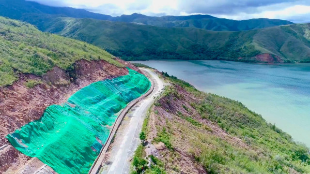
On Segment IV connecting Jayapura, Elelim, and Wamena—specifically the Arso to Waris road section at stations (STA) 25+000 to 28+000—specialists executed structural durability evaluations using advanced Light Weight Deflectometer (LWD) technology. This LWD measurement is vital for determining overlay thickness requirements on roads experiencing mild to severe damage, using the Bina Marga 2017 evaluation standards and AASHTO 1993 guidelines. Technical studies note that this road projects an accommodation of an accumulated Equivalent Single Axle Load of 500,000 ESAL, with strict monitoring of the International Roughness Index (IRI) limited to a tolerance threshold of 6 < IRI ≥ 12. The accuracy of these technical calculations found empirical justification when unstable soil pavement designs failed against extreme weather; in December 2022, at least 150 heavy vehicles, including fully loaded logistics trucks and double-cabin cars, got stuck in mud pools along the Jayapura-Wamena route for nearly three consecutive months, causing a fatal collapse in logistics circulation.
Recognizing the limitations of conventional funding methodologies to conquer such geological terrain, the government introduced a hybrid Public-Private Partnership (PPP) scheme on the most critical segment, the 50-kilometer Mamberamo-Elelim road. PT Hutama Mambelim Trans Papua (HMTP) manages construction on this segment, which stretches from KM 366 in Benawa District to KM 416 in Elelim Sub-district (Yalimo Regency), with a total estimated capital investment ranging from IDR 3.3 trillion to IDR 3.6 trillion. Beginning on July 3, 2024, and targeting commercial operation by November 2026, this concession framework spans 15 years and 4 months (2 years and 4 months of construction and 13 years of maintenance). The project scope is incredibly extensive, including full asphalt paving across five work zones spaced 10 kilometers apart utilizing 150 units of heavy equipment, building 16 new bridge structures, and establishing a permanent weigh station designed to prevent exploitation by overloaded freight vehicles that could destroy the asphalt investment before its economic lifespan ends. This innovative PPP scheme redistributes technical and financial risks to private investors, while the ministry acts as the supervisory authority monitoring asphalt thickness standards and slope stabilization.
Deconstructing the Logistics Paradox and Construction Cost Index (IKK) Dynamics
The fundamental argument supporting the development of the Trans-Papua Road rests on the urgency to eliminate the structural hyper-inflation choking the economy in the Papuan interior. Before the existence of commercial-capacity road networks, pioneering aviation logistics monopolies completely held supply chain distribution hostage in the central mountains. This air supply mechanism produced irrational price deviations; early in its implementation, the price of a 50-kilogram bag of cement in Jayawijaya Regency (Wamena) persistently stood at IDR 800,000, contrasting asymmetrically with Java where it cost only IDR 70,000. Even worse, when weather anomalies restricted takeoff frequencies, commodity scarcity triggered exponential spikes where cement prices could break through thresholds of IDR 1,500,000 to IDR 2,500,000 in more isolated districts. Parallel to this, fuel prices experienced severe distortions, soaring from a rational IDR 6,500 to extreme retail prices exceeding IDR 100,000 per liter during bad weather.
Physical integration radically deconstructs this equilibrium of scarcity. Shifting the primary transport mode from cargo planes to overland truck fleets reduces commodity delivery times from Jayapura to Wamena—which previously took weeks via land-air combinations—to two or three days of intensive travel. Time reduction and shifting cargo weight to high-capacity ground fleets affect the pricing structure proportionally. The Statistics Indonesia (BPS) office in Wamena confirmed this macroeconomic impact institutionally, publishing a consistent downward trend in the Construction Cost Index (IKK) across several mountainous regencies, including Jayawijaya, Central Mamberamo, Yalimo, and Lanny Jaya, during the last five years of road execution.
Economic & Logistics Indicators
| Indicator | Isolation Phase (Pre-Active Overland Road) | Connectivity Transition Phase (Post-Trans Papua Road) |
| Cement Price (per 50kg bag) | IDR 800,000 to IDR 2,500,000 | IDR 450,000 (Up to 70-75% decrease) |
| Fuel Price (per liter in interior) | IDR 60,000 to > IDR 100,000 | Equalized with Java prices via Single Price Fuel policy |
| Expedition Duration (Jayapura-Wamena) | 1 to 2 weeks (multimodal combination) | 2 to 3 days via heavy logistics land routes |
| Primary Transport Mode | Pioneering flights (capacity < 2 tons) | Heavy logistics trucks and trailers (capacity > 10 tons) |
As recorded in statistical data, building cement responded to the opening of the road with the most drastic price depreciation, contracting significantly from IDR 600,000 in previous years to IDR 450,000 per bag, representing a valuation drop of 70 to 75 percent. Declining cement costs transform the architectural landscape of mountain communities, who gradually transition from traditional honai structures to permanent concrete buildings. In line with this success, government intervention enforcing Pertamina’s Single Price Fuel regulation finally materialized efficiently because tank trucks could supply remote filling stations via the overland routes.
Nevertheless, the elasticity of the IKK in Papua shows high fragility toward external shocks. Supply stability and price affordability depend deterministically on two absolute variables: physical pavement viability and territorial security. As an empirical precedent, the IKK recorded a dramatic spike in Jayawijaya Regency when communal social unrest erupted in the Yalimo region three years ago. The security turmoil forced a total closure of access, cut off material supplies, and within days reignited goods scarcity that returned prices to historical inflation points. This evidence reinforces the thesis that physical roads without a supportive security ecosystem cannot sustain lasting logistics independence for communities in the Mountainous Autonomous Regions. Conversely, consistent connectivity stimulates economic aggregation; it opens wider markets for food farmers and river fishermen, while stimulating healthcare and tourism services that rely on stable human circulation.
Customary Land Disposition, the Absence of FPIC, and Legal Transformations
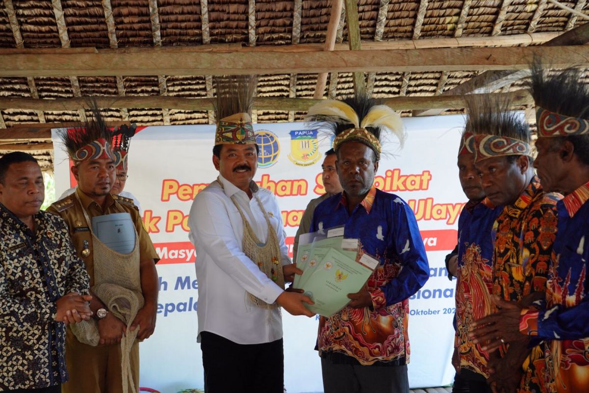
Dissecting the essence of Spatial Justice within infrastructure development brings us to the discourse of territorial conflict between the state as the representation of public power (eminent domain) and customary law communities as holders of communal land entities. The Executive Office of the President (KSP) through its public communication discourse established an affirmative promise that the entire land release process for the Trans-Papua Road megaproject would highly respect the sovereignty and dignity of Indigenous Papuan communities. Authorities declared this policy with a revolutionary spirit of compensation that President Joko Widodo called “Ganti Untung” (compensation for profit), meaning the surrender of ancestral assets must not impoverish communities but must permanently lift the welfare of local citizens.
The reality of land acquisition on the ground reveals a sharp polarization between legislative promises and the socio-cultural trauma suffered by the people. Cases of releasing customary land rights for highway expansion often collide directly with the international principle of Free, Prior and Informed Consent (FPIC), where local residents hold absolute rights to give full consent without pressure before corporate activities begin. As a manifestation of this injustice, land acquisition involving the Momo clan’s customary community on the West Papua route serves as a case study of malpractice. Jurisprudence data reveals that construction executors unilaterally occupied the Momo clan’s land stretches with absolute disregard for communal consultation forums. Members of the indigenous community emphasized that officials never involved them in public consultations, never socialized boundary mapping measurements, and never clarified material compensation or non-material damages.
In Papua, land ownership means more than capital-valued certificate sheets; it acts as a spiritual identity and the epicenter of a clan’s subsistence survival. Unilateral takeovers result in long-term communal income deficits and a loss of livelihood sources. Recognizing the fragile nature of cash compensation, which families quickly consume for secondary needs, customary communities voice a transition in demands; they expect the transfer of communal rights to include long-term investment trusts through Corporate Social Responsibility (CSR) instruments rather than simple one-time payouts. This ideal scheme would dictate project executors or relevant ministries to cover education costs for future generations of affected clans, allocate jobs in the highway sector, and provide continuous basic medical insurance to replace the loss of garden lands that previously supported family life for free. If the absence of compensation dialogue remains a cultural norm, the road claimed as a bridge of unity will instead function as a monument of marginalization for the rightful heirs of Papua.
Geopolitical Security Ecosystems Along the Mountainous Arteries
Reports on infrastructure cannot look complete without including internal geopolitical interventions manifested through chronic, low-scale armed resistance. Within the post-reform conflict landscape, the West Papua National Liberation Army (TPNPB) and criminal armed groups (KKB) often interpret giant infrastructure projects sponsored by the Jakarta regime as manifestations of neo-colonial occupation designed to accelerate mineral extraction and strengthen the military’s territorial grip over their homeland. This anti-colonial awareness fuels a long, bloody conflict along the main axes of the Papuan mountains.
The darkest entry in the highway’s construction history occurred during the December 2018 tragedy in Yigi District, Nduga Regency. In a sudden attack planned with precision, separatist guerrillas executed 19 civilian construction workers from outside the region who worked for the state-owned contractor PT Istaka Karya. These workers were completing a vital bridge infrastructure project along the route. The strategic significance of the Nduga incident highlights more than just the death toll; it signals a transformation in TPNPB combat tactics, repositioning targets from conventional military installations to civilian workers, excavator operators, and logistics elements supporting state projects. After 2018, the wave of attacks expanded beyond the interior Tembagapura-Mimika route, spreading massively to swallow Puncak, Puncak Jaya, Intan Jaya, Lanny Jaya territories, Yahukimo, and the Pegunungan Bintang Regency.
The direct consequence of this asymmetric resistance is the periodic paralysis of project schedules. To eliminate armed sabotage against asphalt fleets and heavy machinery, the state adopts an offensive defense approach by implementing an infrastructure militarization doctrine. Special contingents from the Indonesian National Armed Forces (TNI) Headquarters collaborate with elite Mobile Brigade Corps (Brimob) units from the National Police to form a strict protective cordon guarding returning workers from PT Hutama Karya, who received mandates to rehabilitate landslides in the Mamberamo belt and other red zones. Joint security authorities clear spaces by tracking down individuals on wanted lists (DPO) representing armed group leaders, such as those affiliated with the Aibon Kogoya faction, and suppressing other KKB militias in the central belt.
This militarization tactic, despite intentions designed to ensure stable construction completion, fosters traumatic fear among indigenous people living near these arterial routes. The dominance of joint security forces establishing dozens of armed guard command posts transforms transition villages into zones vulnerable to collateral damage. Sporadic firefights bring economic life to a forced halt. The entire anomaly of bloodshed and escalating troop deployments sends an ironic confirmation that no matter how long a road built through repressive technocratic approaches stretches, it cannot heal historical rifts without dialogues based on socio-political resolution by customary councils. Hardline approaches prioritizing absolute security will continue to feed cycles of retaliation unless balanced with measured demilitarization and diplomatic cultural approaches toward native clan elites.