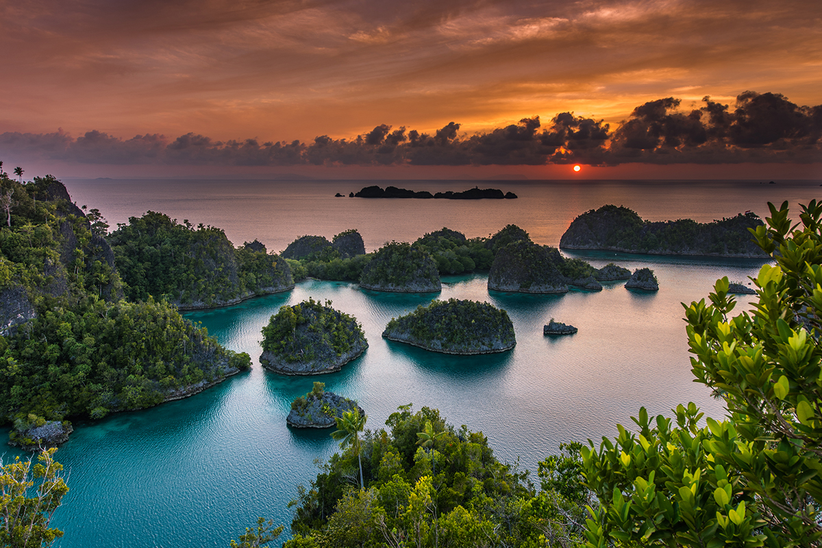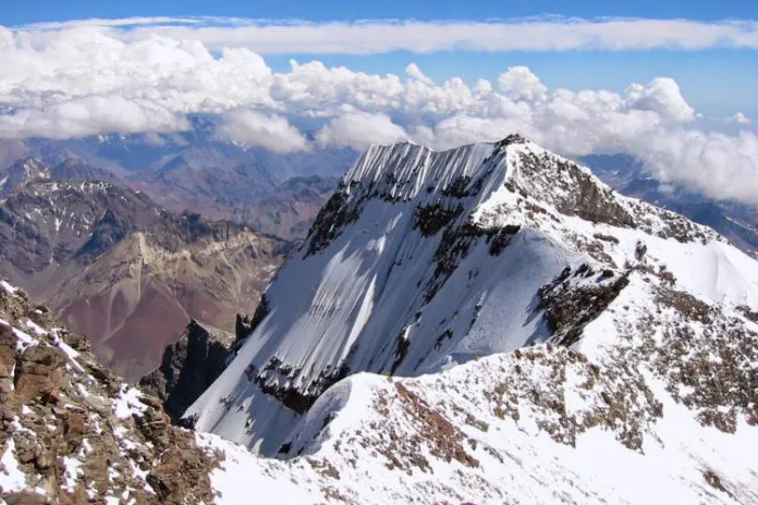
In the global discourse of economic development and resource abundance, popular stereotypes often associate the vast Papua region with the vivid term “land of gold” due to the existence of the world’s largest gold and copper reserves. However, precise geographical and administrative analyses reveal a significant spatial distortion in this traditional label. The massive Grasberg Mining Complex, which PT Freeport Indonesia actively manages, actually sits under the administrative jurisdiction of the Mimika Regency within the Central Papua Province. This colossal industrial footprint in the remote Sudirman Mountain highlands remains geographically isolated thousands of kilometers away from the westernmost tip of New Guinea’s Bird’s Head Peninsula. Conversely, the true, enduring “gold” of western Papua, specifically within the borders of the Raja Ampat Regency, does not emerge from destructive mineral exploitation deep inside the earth. Instead, it manifests beautifully as unparalleled marine biodiversity, pristine coastal ecosystems, and ancient geological wonders that no other place on our blue planet can realistically match.
Geography, Administration, and Deconstruction of the Papuan “Land of Gold”
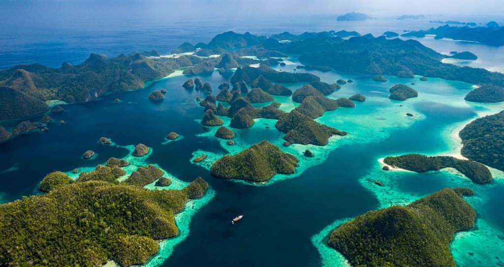
Administratively, the modern regency belongs to the South West Papua Province, which represents a new autonomous region that the central government recently split from the main West Papua Province to improve local governance. With its vibrant administrative capital in Waisai on Waigeo Island, the regency spans across the crucial geographical coordinates of 0°50′ S to 2°25′ N and 130°0′ E to 132°55′ E. Spatial data analysis reveals slight inconsistencies regarding the total island count in historical administrative documents, which record anywhere from 610 to 612 distinct islands. However, comprehensive modern satellite mapping proves that this massive archipelago actually encompasses more than 1,500 small islands, rugged cays, and isolated shoals scattered across 59,820.01 square kilometers of productive marine waters.
Out of these numerous islands, permanent indigenous communities inhabit only about 35 islands, while the remaining uninhabited islands lack official cartographic names. Four large islands—frequently termed “The Big Four”—sustain the main physical and logistical structure of the entire archipelago, namely Waigeo, Batanta, Salawati, and Misool. Among these four primary islands, Misool Island consistently attracts the most international tourists because of its dramatic karst rock formations and exceptionally strict marine protected area networks.
Geographical, Demographic, and Administrative Comparison of Raja Ampat’s Main Islands
| Main Island | Land Area (km2) | Estimated Population (Mid-2025) | Number of Administrative Districts | Highlighted Destination Characteristics |
| Waigeo | 3,514.85 | 42,367 | 13 | Administrative center (Waisai), primary habitat of Wilson’s Bird-of-Paradise, Mayalibit Bay |
| Misool | 2,440.78 | 16,720 | 6 | Ancient karst formations, prehistoric caves, concentration of exclusive resort tourism |
| Salawati | 1,111.50 | 6,653 | 3 | Sago forest transition zone, wartime historical sites, close logistical proximity to Sorong |
| Batanta | 479.52 | 3,999 | 2 | Inland waterfalls, Red Bird-of-Paradise habitat, close proximity to several notable WWII plane wreck sites |
Source: Reconciled Demographic Census and Spatial Planning Data of Raja Ampat Regency.
The recent administrative division of the South West Papua Province brings transformative impacts to the governance and long-term protection of the region. This government decentralization significantly strengthens local fiscal capacity and expands regulatory authority to manage regional economic potential independently without distant bureaucratic delays. While complex conservation coordination previously required a long, inefficient bureaucratic chain stretching to Manokwari, it now centers in Sorong, which acts as the primary logistical and maritime gateway to the islands. This structural shift directly improves the overall efficiency of marine protected area surveillance, because local task forces can respond immediately to maritime zoning violations, illegal fishing incursions, and marine transport accidents in the surrounding waters.
Sociocultural Analysis of the Ancient Myth and the Integration of the Tidore Sultanate
The famous name of the archipelago, which literally translates to “The Four Kings” in the Indonesian language, originates directly from local indigenous oral traditions and fascinating mythological cosmology. Contradictory narrative variations exist between popular commercial tourism documents and the collective memory that professional anthropologists record from village elders. In original popular manuscripts, a local hunter and his wife find six mysterious dragon eggs hidden near their settlement. Five of these eggs eventually hatch into five distinct humans, comprising four males and one female. The four brothers later kill their only sister due to social taboos and crown themselves as independent kings of Waigeo, Salawati, Batanta, and Misool, thus forming the traditional ruling class of the islands.
However, deep ethnographic studies record a far more dominant, spiritually significant version among the indigenous Maya Tribe. In the Maya Tribe’s ancient cosmology, a noble woman finds seven sacred eggs on the serene banks of the Waikeo River. Four eggs hatch into four strong boys who establish powerful ruling dynasties on the four main islands. The fifth egg hatches into a restless ghost, the sixth hatches into a beautiful woman whom villagers quickly exile to Biak Island via a wooden boat due to an unexplained, mysterious pregnancy, and the seventh egg turns entirely to stone instead of hatching. To this very day, the local indigenous inhabitants deeply revere the stone egg as a sacred ritual object, keeping it carefully inside a protective container wrapped in clean white cloth within a traditional ceremony house near the Waikeo River, completely hidden from public view or tourist interference.
Comparison Matrix of Mythological Variations on the Origin of the Name Raja Ampat
| Analytical Parameter | Six-Egg Variant (Popular Manuscript) | Seven-Egg Variant (Maya Tribe Indigenous Cosmology) | Socio-Anthropological Implications |
| Number of Eggs | 6 dragon eggs | 7 dragon/sacred eggs | Determines the spiritual representation of the physical entities and boundaries across the region. |
| Hatching Outcomes | 5 humans (4 men, 1 woman); 1 egg remains unhatched | 4 men, 1 woman, 1 ghost, and 1 permanent stone egg | Reflects the traditional cosmological division between the human world, spirits, and sacred inanimate objects. |
| Fate of Female Character | Her four jealous brothers brutally kill her | People cast her to sea due to pregnancy, then the King of Biak saves her | Explains historical kinship ties, complex marriage alliances, and maritime migration routes between islands. |
| Territorial Sovereignty | Direct, violent distribution of secular power over the four main islands | Spiritual lineage of indigenous dynasties confirms absolute territorial sovereignty | Legitimizes traditional leadership structures (known locally as Fun or Jaja) over ancestral customary lands. |
Source: Synthesis of Oral Tradition Narrative Structures in the Papuan Bird’s Head Archipelago, standardizing tribal oral histories.
From a rigorous political history perspective, the critical shift from local mythology to a formal regional political order occurred alongside the aggressive eastward expansion of the powerful Tidore Sultanate from North Maluku during the 15th century. The visionary Sultan of Tidore cleverly utilized this existing mythological structure to consolidate his geopolitical power by formally appointing the local rulers in Waigeo, Salawati, Batanta, and Misool as official regional administrators, granting them the prestigious title of Kolano or Fun. The archipelago then rapidly transformed into an important, highly strategic trading corridor within the global spice trade network. Its unique geographical location attracted bold Arab sailors, affluent Chinese merchants, and competitive European explorers who eagerly traded high-value commodities like cloves, nutmeg, wild pearls, and exotic birds-of-paradise, thereby accelerating profound cultural, linguistic, and religious assimilation across coastal Papua.
The World’s Most Complete Coral Reef Ecology and Bio-Oceanographic Drivers
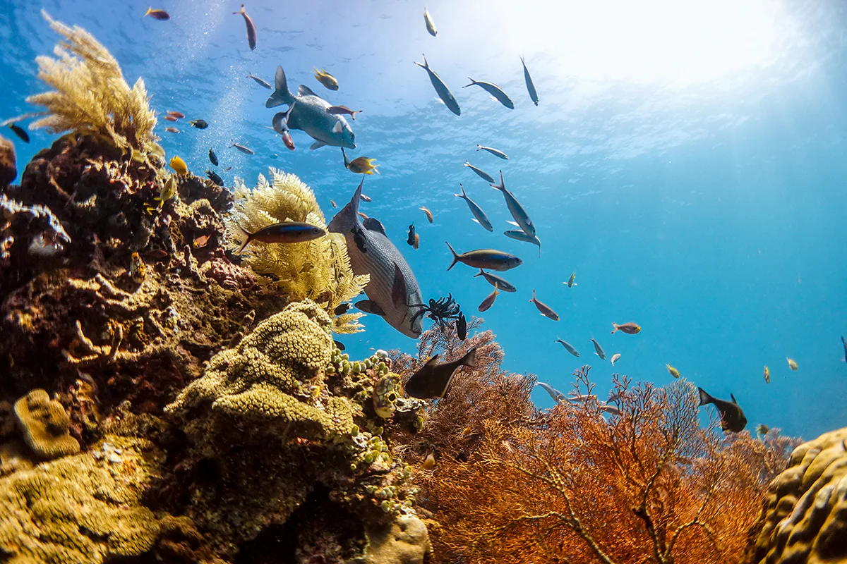
The undisputed international status of the region as Earth’s ultimate marine sanctuary relies heavily on its extraordinary ecological standing as the world’s richest marine biodiversity hotspot. Its strictly protected land and sea zones cover approximately 4.6 million hectares of pristine habitats. Comprehensive marine research shows that this specific region hosts between 540 and 600 distinct hard coral species, representing roughly 75% of all identified coral species globally. This astonishing density contrasts sharply with other tropical marine regions around the world; live coral cover in major monitoring sites like the Dampier Strait, Kofiau Islands, East Misool, and the iconic Wayag Islands remains virtually pristine, regularly boasting survival rates well above 90% despite global industrial pressures.
A global-scale physical oceanographic phenomenon, the Indonesian Throughflow (locally termed Arlindo), fundamentally drives this incredibly high marine biodiversity. The strategic location of the islands at the complex crossroads of the Pacific and Indian Oceans makes them a primary, high-volume channel for water mass movement. Powerful marine currents crossing the archipelago bring massive, continuous supplies of vital nutrients, diverse coral larvae, and abundant plankton, constantly fueling the complex reef ecosystems.
This dynamic water circulation mechanism also triggers frequent upwelling events, which lift cold, nutrient-rich deep-sea water directly to the shallow surfaces. This periodic cold current acts as an invaluable natural thermal shield that effectively protects local reefs from thermal stress and catastrophic mass bleaching, making the entire region a resilient, world-class evolutionary refuge amid the accelerating global climate crisis.
Marine Biota Diversity Comparison: Raja Ampat vs. Global Statistics
| Taxonomic Group | Estimated Species Count in Raja Ampat | Percentage of Total World Species | Ecological and Conservation Status |
| Hard Corals (Scleractinia) | 540-600 species | 75% | Protected status; highly resilient but vulnerable to sudden temperature spikes |
| Coral Reef Fish | 1,511 species | 35-40% | Extremely high density; Labridae, Pomacentridae, and Serranidae families dominate the reefs |
| Marine Mollusks | 550-700 species | Highest world record density | Includes critically endangered species such as the majestic giant clam (Tridacna gigas) |
| Sea Turtles | 6 out of 7 global species | 85% | National and international environmental laws fully protect all resident species |
Source: Conservation International Biodiversity Inventory Data and official environmental updates from the local Geopark.
World War II Maritime Archaeology, Wreck Biota Spectra, and Pioneering Exploration
During the turbulent years of World War II, the specific geographical position of the islands on the western edge of the Pacific Theater made them a fierce, strategic maritime battleground for Allied forces and the Imperial Japanese Navy. Fascinating war remnants now lie scattered across the seabed as silent shipwrecks and downed warplanes, which have slowly transformed over the decades into vibrant artificial reefs. The most prominent maritime archaeology sites include:
- P-47D Thunderbolt Wreck: An American tactical fighter aircraft that crashed on October 21, 1944, in shallow waters near Wai Island, south of Batanta Island. It lies completely upside down at a depth of 26 to 33 meters on a clean sandy substrate. The propellers, wings, and cockpit remain highly intact, completely covered by pink Alcyonium soft coral colonies and inhabited by sweetlips, lionfish, and massive mantis shrimp.
- Cross Wreck: Located near Kri Island at a depth of 18 meters, this Japanese wooden patrol boat gets its name from a Christian missionary cross standing on the nearby beach. Novice divers can easily access this site, which is teeming with lionfish, mantis shrimp, leaf fish, and devil fish camouflaged among the collapsed hull.
- Shinwa Maru: A large Japanese military cargo ship resting at extreme depths, presenting a serious technical challenge for professional divers. The ruins host massive sponge colonies, barracudas, and red snappers.
A former Dutch mechanic and passionate military vehicle collector named Max Ammer single-handedly pioneered the early diving exploration routes in this remote region. In 1989, Ammer originally traveled to Morotai to find abandoned wartime jeep parts, where he heard intriguing rumors of sunken military aircraft in the western Papuan waters. Ammer immediately decided to explore the treacherous Dampier Strait using regular public ferries and basic, uncertified diving gear. Despite lacking any standard tourism infrastructure—with no air compressors, proper medical facilities, or professional dive guides available—Ammer conducted dangerous solo exploration dives in currents notorious for their unpredictable shifts.
During his search for historical iron artifacts, Ammer suddenly realized that the breathtaking underwater beauty of the area represented an unmatched, irreplaceable ecological asset. Wanting to protect the vulnerable region from destructive blast and cyanide fishing, Ammer founded Papua Diving Resorts in 1993, establishing the very first functional dive resort in the area. He dedicated his life’s work to empowering indigenous Papuans through intensive technical skill transfer, eventually establishing the RARCC Foundation to train local youth in building eco-friendly boats, constructing schools on Batanta, and installing clean rainwater harvesting systems.
Terrestrial Biogeography, Avifauna Corridors, and the Legacy of Alfred Russel Wallace
Although breathtaking underwater beauty dominates global media coverage, the terrestrial ecosystems here hold equally high biological value due to their unique position within a transitional biogeographical zone. Dense lowland rainforests and rugged karst hills harbor various endemic fauna, ranging from rare marsupials like the Waigeo cuscus (Spilocuscus papuensis), unique maleo birds, colorful parrots, and loud sulphur-crested cockatoos (Cacatua galerita), to legendary birds-of-paradise (Paradisaeidae). Among local bird-watching spots, Sawinggrai Village on the southern coast of Gam Island stands out as a crucial, globally recognized avifauna sanctuary.
This beautiful coastal village offers direct access to primary forest habitats where Red Birds-of-Paradise perform elaborate courtship rituals. Tourists can observe the spectacular courtship dances of male birds during specific, predictable windows: mornings from 07:00 to 08:00 WIT and late afternoons from 16:00 to 17:00 WIT. Sawinggrai Village features comfortable, eco-friendly homestays managed directly by the local indigenous community, allowing researchers and passionate birdwatchers to stay for weeks at a time.
Biological Characteristics of Endemic Birds-of-Paradise
| Biological Attribute | Red Bird-of-Paradise (Paradisaea rubra) | Wilson’s Bird-of-Paradise (Cicinnurus respublica) |
| Geographical Distribution | Strictly endemic to Waigeo, Batanta, and Gam Islands | Limited endemism to Waigeo and Batanta Islands only |
| Male Morphology | Size 32-34 cm, crimson red plumage, a pair of coiled black tail wires | Size 16 cm, bald turquoise blue head skin, yellow collar, spiral coiled tail feathers |
| Display Location | High, sunny forest canopy layers | Cleared court on the dark forest floor (understory) |
| Courtship Dance Style | Group dance (lek); hangs upside down while vigorously flapping red wings | Solitary; displays an iridescent green breast shield on thin vertical stems |
Source: Field Observations from the Papuasia Ornithological Guide, tracking avian behaviors and mating rituals.
The region’s rich terrestrial biogeographical value connects deeply to international scientific history through the legendary adventures of the famous British naturalist Alfred Russel Wallace. In 1860, Wallace landed on Waigeo Island and set up a simple, isolated research camp near Yenbeser Village to collect exotic specimens. For many exhausting months, he dedicated himself to collecting Red Bird-of-Paradise specimens and carefully observing minute species variations between neighboring islands.
Wallace brilliantly noted that bird species with limited flight capabilities or stark geographical barriers showed incredibly high rates of speciation due to long-term isolation by deep sea straits. His revolutionary findings in Yenbeser provided crucial empirical evidence for the timeless Theory of Evolution through Natural Selection, which he famously formulated independently alongside Charles Darwin, forever cementing the archipelago’s international status as a living evolutionary laboratory.
Environmental Governance, Customary Sasi Law, and Regenerative Tourism
Despite its remarkably high ecological resilience, expanding human activities continuously threaten the fragile preservation of local waters and land. The uncontrolled, rapid growth of informal homestays and commercial resorts along the coastline triggers severe soil sedimentation that directly threatens sensitive shallow coral growth. Domestic wastewater containing harsh detergents causes localized eutrophication, where excess nutrients fuel rapid algae blooms that systematically smother and kill vital hard coral colonies. Additionally, the dark legacy of destructive blast and potassium cyanide fishing from the 1980s left massive stretches of dead coral rubble that simply cannot recover naturally without direct physical substrate intervention and active human restoration.
To address these urgent ecological challenges, the local government collaborates closely with international conservation organizations like Conservation International (which smoothly transitioned its primary operations to Konservasi Indonesia in 2021) to implement community-based conservation frameworks. The highly successful Marine Protected Area (MPA) Network, established originally in 2004, deeply integrates traditional Papuan customary law known locally as Sasi.
The core principle of Marine Sasi involves a strict customary ban on harvesting specific marine commodities within a timeline collectively agreed upon by village elders. This closure usually lasts one to two consecutive years, giving vulnerable marine biota like octopuses, sea cucumbers, giant clams, and lobsters a fair chance to reach full reproductive size and rebuild wild populations. When the highly anticipated opening ceremony (known as buka sasi) finally occurs, community members may only harvest commodities using traditional, non-destructive gear and strict minimum size limits, ensuring long-term food security and exceptional economic resilience for the entire village.
Active underwater restoration projects also work tirelessly to rebuild destroyed reef areas across the archipelago. Through the innovative Yaf Keru Restoration Program, which the non-governmental organization The Sea People actively manages, local indigenous youth receive professional training as skilled coral gardeners. The program has successfully planted more than 85,709 healthy hard coral fragments and restored over 2.82 hectares of degraded reef in the strategic Dampier Strait. This restoration effort utilizes specialized steel mesh structures that stabilize loose coral rubble, effectively stopping the destructive avalanche phenomenon that can damage healthy coral colonies below.
Long-term success now depends heavily on transitioning from a basic sustainable tourism model to a truly regenerative tourism model. While sustainable tourism focuses entirely on minimizing human damage, regenerative tourism demands active tourist involvement to restore, fund, and enhance the visited ecosystems. Visitors no longer act as passive spectators, but instead integrate directly into tangible conservation activities. Through regenerative tourism schemes, a portion of entry fees goes directly toward financing indigenous marine patrols, supporting community plastic waste management on small islands, and funding hard coral nurseries supervised by local scientists. Thus, the tourism sector directly strengthens ecological resilience against global climate change while safeguarding the customary rights and sociocultural well-being of the indigenous communities for generations to come.