I. Introduction: Unveiling the Potential of Indonesia’s Eastern Frontier
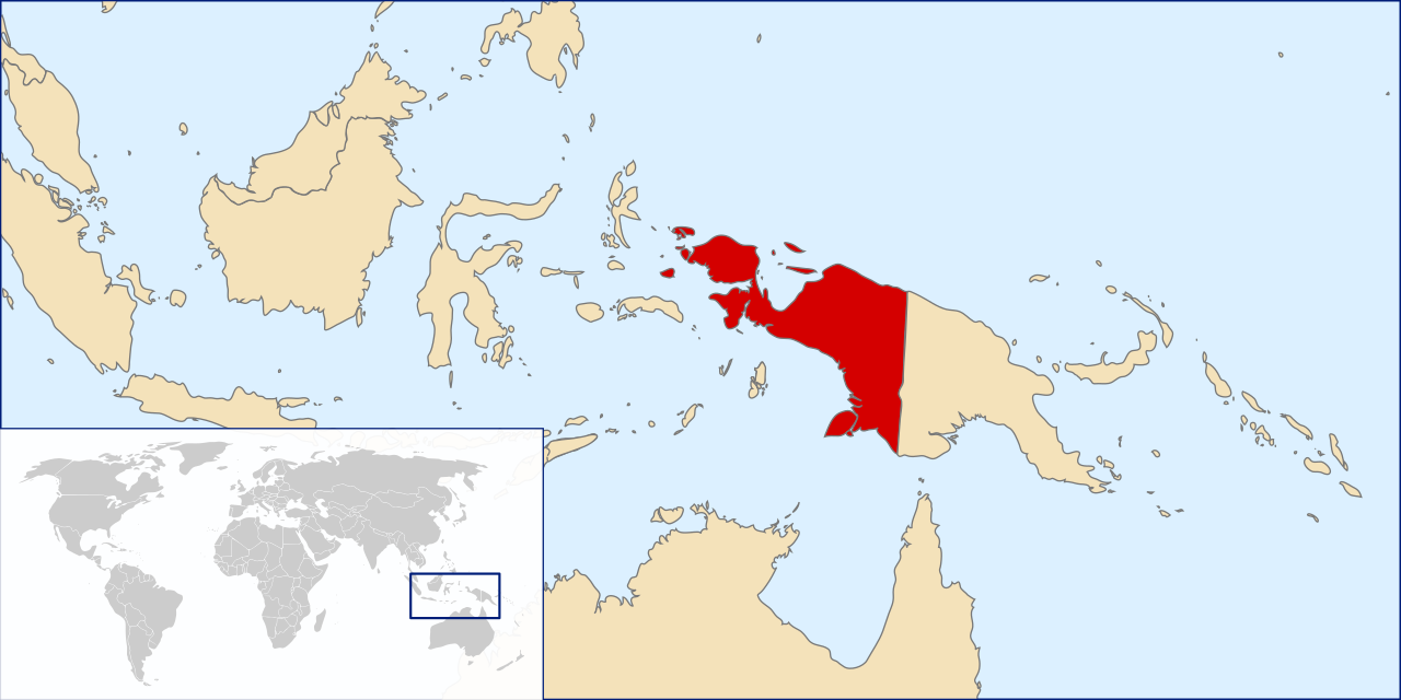
The region collectively known as West Papua —spanning the western half of the island of New Guinea under the sovereignty of the Republic of Indonesia—stands as one of the most complex cultural, ecological, and geopolitical frontiers in the Indo-Pacific.
The narrative surrounding this region often falls into a “paradox,” contrasting its unparalleled West Papua nature with complex human development challenges. However, a deep analysis of the dynamics in 2024 and 2025 reveals that this narrative is shifting towards a structural transition driven by modernization, asymmetric decentralization, and deeper economic integration into Indonesia.
For international observers, understanding West Papua requires appreciating the scale of its transformation. The region, once a single province, has now expanded into six distinct administrative entities to cut bureaucratic red tape and accelerate service distribution.
The Dual Meaning of “Independence”
In the socio-political discourse of the region, the concept of “independence” has layered resonances. While August 17th (Indonesia’s Independence Day) is celebrated widely, the date of December 1st often sparks historical debate. Some observers might search for the phrase ” happy independence day West Papua ” in reference to the 1961 flag-raising event. However, rigorous historical analysis clarifies that the 1961 event was a unilateral administrative act by the colonial Dutch power, not a legally recognized independence, and was later superseded by international agreements like the New York Agreement. For communities in remote areas like Airu, “independence” is often pragmatically defined as freedom from isolation through access to healthcare, education, and infrastructure.
II. Comparative Analysis: West Papua vs. Papua New Guinea
One of the most common queries globally is regarding the difference between West Papua and Papua New Guinea . Although they share the same landmass and identical Melanesian ancestry, they have evolved into two fundamentally different worlds. The border at the 141st meridian east is not just an administrative line; it demarcates distinct colonial histories and political systems.
2.1. Colonial Heritage and Sovereignty
The core difference between West Papua and Papua New Guinea lies in their colonial lineages.
- West Papua (Indonesia): Was part of the Dutch East Indies. Its integration into Indonesia was finalized through the 1969 Act of Free Choice, recognized by the UN.
- Papua New Guinea (PNG): Had a fragmented history involving Germany and Britain, later administered by Australia. It achieved sovereignty as an independent Commonwealth realm in 1975.
So, is West Papua part of Papua New Guinea ? No. West Papua is a region within the sovereign state of Indonesia, whereas Papua New Guinea is a separate independent country.
2.2. Political Structures and Demographics
When comparing Papua New Guinea vs West Papua , the governance structures differ sharply.
West Papua operates under Indonesia’s presidential system with “Special Autonomy” status, using Bahasa Indonesia as the sole lingua franca to foster national integration.
Papua New Guinea is a constitutional monarchy with a parliamentary system. It is the most linguistically diverse nation on earth, using Tok Pisin and English to bridge its 840+ languages.
Key Indicators – West Papua vs. Papua New Guinea
| Indicator | West Papua (Indonesia) | Papua New Guinea |
|---|---|---|
| Political Status | 6 Provinces (Special Autonomy) | Sovereign State (Commonwealth) |
| Population | ~5.6 Million (2022 est.) | ~11.8 – 17 Million |
| Official Language | Bahasa Indonesia | English, Tok Pisin, Hiri Motu |
| HDI | 0.655 (2024 avg) | 0.568 (2022) |
III. Geography & Administration: The New Map
The administrative landscape has undergone a seismic transformation. To address the vast geography, the government expanded the region into six provinces. This expansion answers the search intent for West Papua capital cities and regional governance.
3.1. The Capital & Major Cities
- Manokwari: Serving as the capital of West Papua province, Manokwari is historically significant as the “City of the Gospel” and sits on the scenic Doreri Bay.
- Sorong: Often searching for cities in West Papua leads to Sorong. It is the largest city in the western section and the capital of the newly formed Southwest Papua province . As a logistics hub, Sorong is the primary gateway to Raja Ampat and plays a vital role in maritime trade.
- Merauke: The capital city of West Papua province Indonesia ‘s southern region (South Papua Province). It is known for its flat terrain and agricultural potential.
3.2. Southwest Papua: A New Economic Hub
The establishment of South West Papua (Papua Barat Daya) as the 38th province of Indonesia marks a new era. Centered in Sorong, this province encompasses the resource-rich territories of Raja Ampat, Tambrauw, and Maybrat, focusing on tourism and conservation.
IV. Demographics: Population & Human Development
The West Papua demographics are dynamic, characterized by a mix of indigenous tribes and migrants, with a young and growing population.
4.1. Population Trends 2024/2025
Data regarding West Papua population 2025 indicates a steady upward trend.
- Current Estimates: The total population across the region is approximately 5.6 million.
- Growth Factors: The West Papua population 2024 data shows growth driven by natural increase and migration to new economic centers like Nabire and Sorong. Nabire, for instance, has seen its population grow to over 178,000 by mid-2024.
4.2. Human Development Index (HDI)
Contrary to stagnation narratives, the HDI in the region has shown consistent improvement, rising from 62.76 in 2020 to 65.46 in 2024 . This reflects tangible progress in education, healthcare, and per capita income.
V. Culture & Heritage: A Mosaic of Traditions
The cultural wealth of the region is a primary driver of interest, particularly regarding West Papua tribes and their unique traditions.
5.1. Indigenous Tribes
The region is home to hundreds of West Papua tribes , each with distinct languages and customs. Key groups include the Dani and Lani in the highlands, the Asmat in the southern swamps, and the coastal Biak people.
5.2. Traditional Attire & Clothes
Queries about West Papua traditional clothes often lead to the iconic Koteka and Noken .
- Koteka: This West Papua traditional attire for men is made from a dried water gourd (Lagenaria siceraria). Far from being mere covering, the angle and size of the Koteka communicate social status and masculinity.
- Noken: A knotted net bag made from wood fiber or leaves. Recognized by UNESCO, the Noken symbolizes the womb and is a central element of Papuan life, used for carrying everything from produce to babies.
- Traditional Houses: The Honai (men’s house) and Ebei (women’s house) of the Dani tribe are architectural marvels designed to trap heat in the freezing highlands.
VI. History: The Act of Free Choice
Understanding the region’s integration requires examining the Act of Free Choice West Papua (Pepera) of 1969.
6.1. The Process
Mandated by the 1962 New York Agreement, this act determined the final status of the territory. It utilized a consensus system (musyawarah) involving 1,025 representatives rather than a universal vote, a method agreed upon due to the logistical challenges of the time.
6.2. International Recognition
The result, which favored integration with Indonesia, was accepted by the UN General Assembly through Resolution 2504. In international law, this marked the finality of decolonization.
VII. Tourism: Hidden Paradises
7.1. Raja Ampat (Southwest Papua)
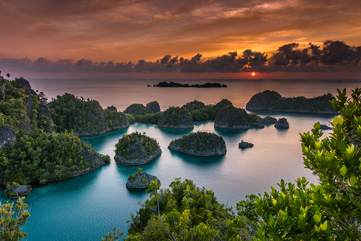
Located in the new Southwest Papua province , Raja Ampat is the crown jewel of marine tourism, famous for the highest marine biodiversity on Earth.
7.2. Cenderawasih Bay (Central Papua)
The main gateway is Nabire. This national park is renowned for its resident whale sharks (Rhincodon typus), which can be seen year-round, offering a world-class ecotourism experience.
7.3. Fakfak & Kaimana
Known for the “Twilight Kingdom” of Kaimana and the historic spice trade in Fakfak. Attractions include the Kiti Kiti Waterfall which falls directly into the ocean.
VIII. Nature: From Glaciers to Mangroves
The West Papua nature is defined by extremes, hosting the largest mangrove forests and the highest peaks between the Himalayas and the Andes.
8.1. Highest Mountain in West Papua
The region is home to the highest mountain in West Papua , the Carstensz Pyramid (Puncak Jaya) , standing at 4,884 meters above sea level.
- Tropical Glaciers: It is one of the few places in the tropics where permanent ice exists, though it is retreating due to climate change.
- Other Peaks: Other significant summits include Puncak Mandala (4,760 masl) and Puncak Trikora (4,750 masl).
8.2. Unique Ecosystems
From the alpine tundra of the Jayawijaya mountains to the sago forests of Yoboi village, the region’s biodiversity is immense. The diverse topography creates microclimates that support rare species like the Birds of Paradise and thousands of endemic orchids.